 :
:The top photo is an overhead of Republic Airport and General Aviation field
in Farmingdale, NY. www.republicairport.net .
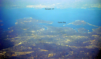
The second photo has a view of Western Suffolk County, NY in the lower half.
Southern Fairfield County, CT is clearly visible in the top half.

The third photo has an aerial view of MacArthur Airport, (ISP). Unlike the NYC Airports, ISP is hardly ever delayed. It is also very easy to reach which
makes it a very good alternative to flying out of LGA or JFK.

www.macarthurairport.com .

We cross Long Island Sound and pass over Point Judith as we begin our
descent.


No comments:
Post a Comment